
2014: Cedar Grove to Rae Lakes Loop
Cedar Grove to Rae Lakes Loop
(42 miles + 20 miles of day hikes)
June 21–28, 2014
Nick, Omi, Chris, and Clara
(This hike was organized through MeetUp)
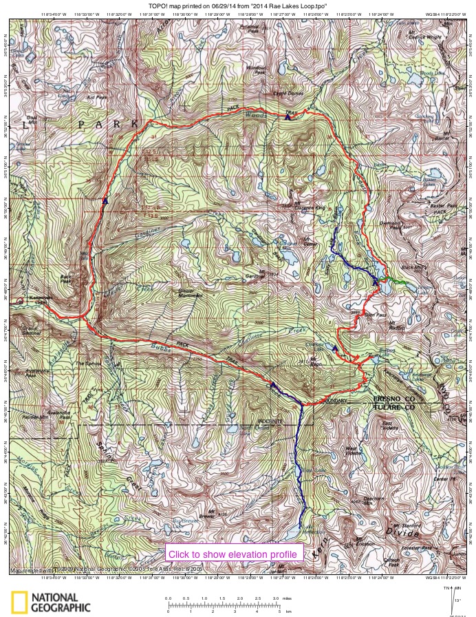
This basic trip is described in Sierra South, though we did it in the reverse (counterclockwise) direction, with various side trips.
Day 1: Car camp at Cedar Grove
Day 2: Cedar Grove Road’s End to Junction Meadow (10 miles)
Day 3: Junction Meadow to Reflection Lake day hike (11 miles round-trip)
Day 4: Junction Meadow to Charlotte Lake (7 miles) (including side trip to Bullfrog Lake)
Day 5: Charlotte Lake to Rae Lakes (5 miles)
Day 6: Day hike to Sixty Lakes Basin (apx, 6 miles round-trip), then Rae Lakes to Woodcreek Crossing (8 miles)
Day 7: Woodcreek Crossing to Lower Paradise (9 miles)
Day 8: Lower Paradise to Road’s End (6 miles)
Day 1: To Cedar Grove
I signed up for this hike with a MeetUp group. Omi was the organizer of the hike. We all met for dinner one evening a couple of days before the hike to go over details. Omi and Chris knew each other from a previous hike, and had become friends and hiking buddies. The rest of us had not met before. Omi and Chris are ultralight hikers, with base weights of 12-15 lbs. Clara and I had packs with base weights of around 25-28 lbs. Lisa was the fifth hiker, but due to various issues she had to turn back after the first leg.

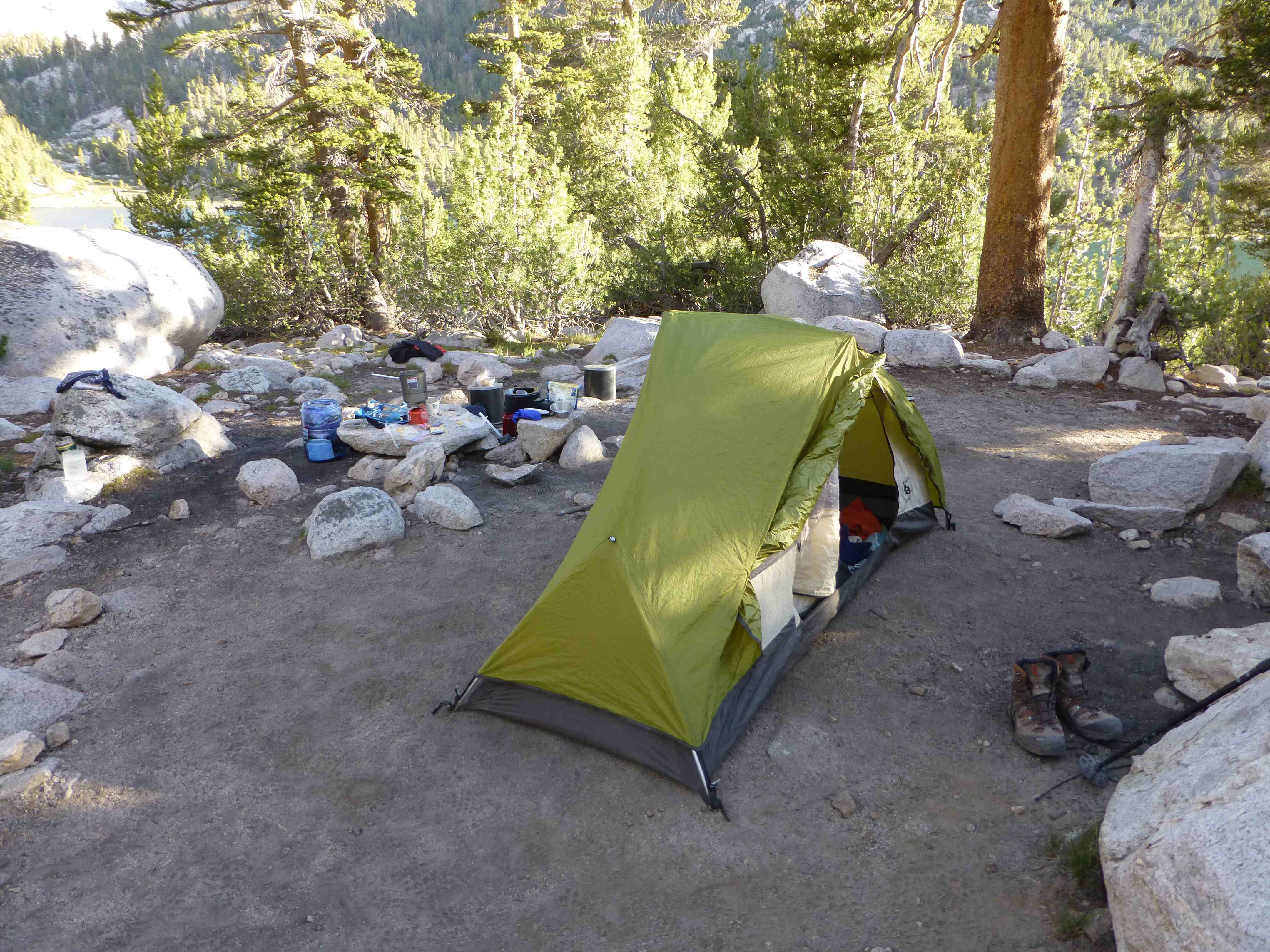
Cedar Grove Campground
Omi, Lisa and myself carpooled together, and Clara and Chris were in another car. Our car left around 11am, but Chris and Clara did not get off for several more hours, so we all met at the campground. The Cedar grove car camping was quite crowded. The people next to us were talking loudly until about 1:30 am, including a baby that cried for over an hour near midnight. Then there was more conversation around 3am, and then one of them was getting sick at 5am, so none of us got a great night’s sleep that night.
Day 2: Cedar Grove Road’s End to Junction Meadow (10 miles)

5,100′ – 8,100′
We had been discussing which way to do the loop. The common direction is clockwise, mainly because it is a more gradual ascent to start. However, our permit was for counterclockwise. We were hoping they would not care, but when we asked the ranger, he was clear that the permit was only for going counterclockwise. Due to the popularity of this route, they limit it bow many they want in each area per day.

Chris, Clara, NIck, Omi, Lisa
The trail follows Bubb’s Creek virtually all the way up. After getting our permit, we headed out on the trail at about 9:30. We stopped for lunch noonish. I got in my first quick dip of many to come in the river there. At our lunch spot we met a group of guys who call themselves “Trail Angels” who hike up with lots of food to give PCTers and extra meal.

Near Charlotte Creek crossing we saw a rattler shading himself behind a rock right on the trail.

We stopped about 1/2 mile before the actual junction at a nice campsite by the creek. We built a nice campfire that evening. Mosquitoes were medium –pretty much that way the whole trip.

Due to various circumstances Lisa had to turn back, leaving the four of us.
Day 3: Junction Meadow to Reflection Lake day hike (11 miles round-trip)
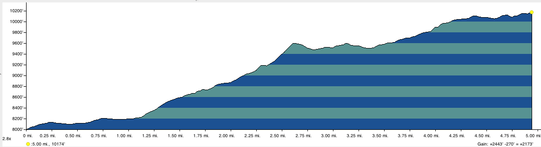
8,000′ – 10,200′ (and back)
Today we took a side trip to Reflection Lake and back. We left at 10am. First we headed up the trail about half a mile to the junction.

Omi crossing Bubb’s Creek
From there we took the trail to East Lake. Soon after turning off the main trail we had to ford Bubb’s Creek. The water was at least to the tops of our thighs and fast moving. There was a string across to help, but with poles it was not useful. Omi managed to lose one of his poles while crossing. Soon after that there is another river crossing, but this time they provide a bridge!

East Lake
We got to East Lake at about 12:30 and had lunch there. The trail to Reflection lake is more of a use trail, sketchy at times, and there is some boulder hopping along the way.

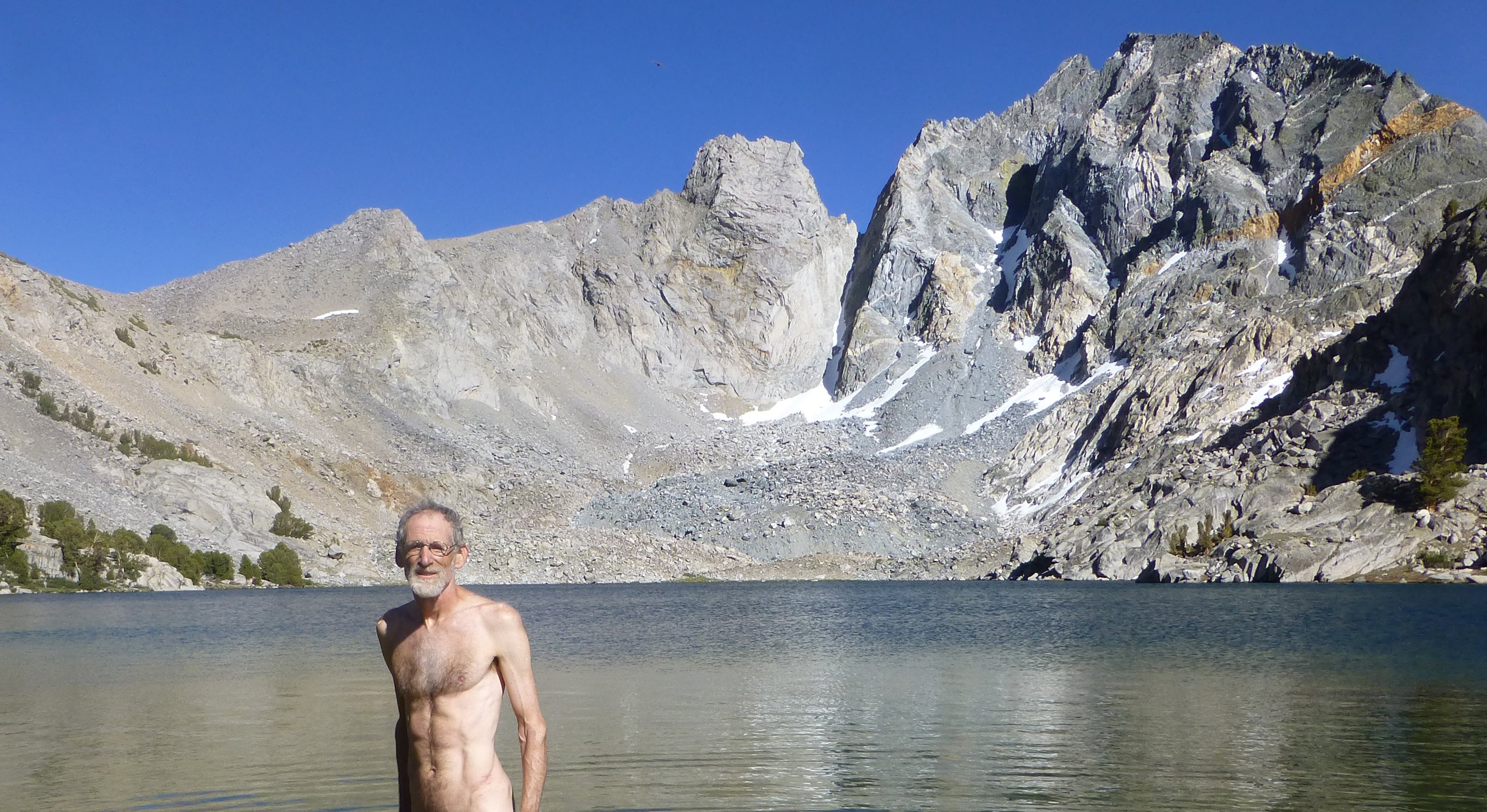
We got there at about 3pm. We did not spend a lot of time there as we needed to head back, and arrived back at camp around 6:30pm. Though I did get in a quick dip.

Reflection Lake
That night Omi discovered that the Everclear fuel he brought for his alcohol stove did not burn at high altitudes. I had given Lisa my stove when she left the group. That left Omi and myself sharing Clara’s stove with her, which lasted almost until the end of the trip.
Day 4: Junction Meadow to Charlotte Lake (7 miles) (including side trip to Bullfrog Lake)

8,100’–10,800–10,500′
We got started at about 8:30. Had about a 2,000′ climb. We got to the junction for Bullfrog Lake at around noon, and decided to take the 1/2 mile trip to it for lunch. There was a little confusion on the way there. Clara was slightly behind us, and thought the first lake was Bullfrog lake and stopped there, while the other 3 of us went on not realizing she had stopped there. But after waiting for her at Bullfrog for awhile, Omi went back and got her.

Bullfrog Lake was magnificent. I took a dip there, and then on the way back the 3 guys took a dip in the smaller lake. Then we headed on to Charlotte Lake, about a mile or so off the main trail, down about 500′. We arrived there at about 5pm.
Charlotte lake is a large lovely lake nestled in a valley. Good camping all along the trail side. There is a ranger station there. I took another dip there with a couple that was from the LA area.

Day 5: Charlotte Lake to Rae Lakes (5 miles)
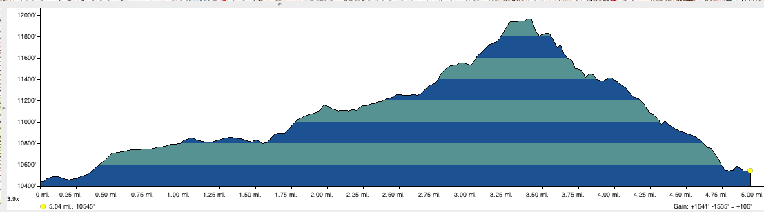
10,400’–12,000’–10,600′
After breakfast etc, we left camp around 8:45. First we climbed back up form Charlotte Lake, then turn left at the junction to head up to Glenn Pass.

Nick at Charlotte Lake in the morning
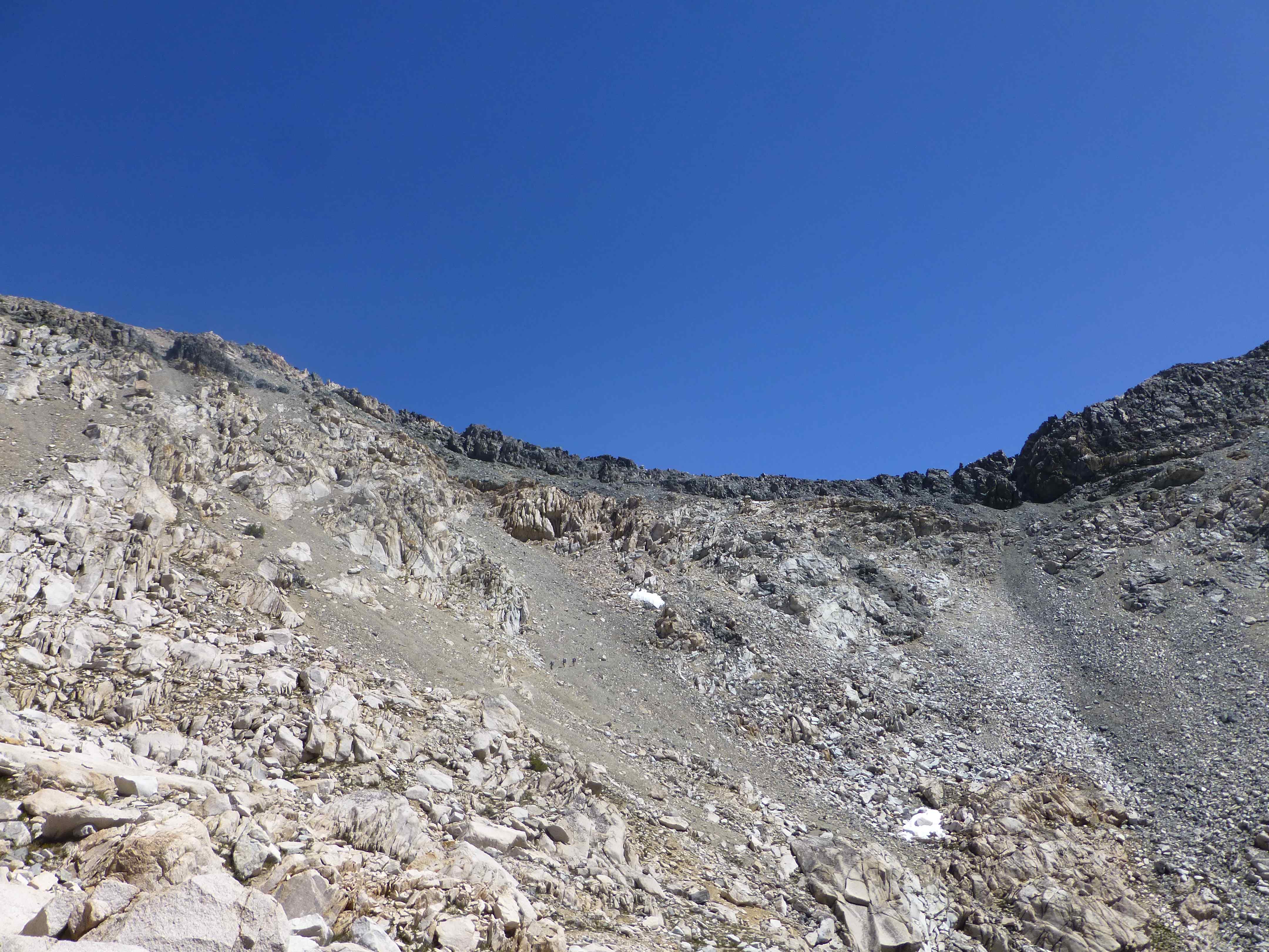
Looking up to the pass
It is a steady climb and we could soon see the pass–quite high and at first daunting looking, but as there is a well developed trial it is really just steady going, with magnificent views.
Omi was concerned about getting over the pass and down the side with snow while still early and the snow not so soft, so he wanted to get there as early as possible.
Clara and I took the climb a bit slower.

Looking back from the pass

At Glenn Pass–photo courtesy Chris
The views at the pass were magnificent, looking both back where we came from and also down to the Rae Lakes. After meeting Omi and Chris there, they went on as Clara and I stayed for a bit. On the descent there were short stretches of deep snow, but as many people had passed before there were good paths through it as long as one was careful.
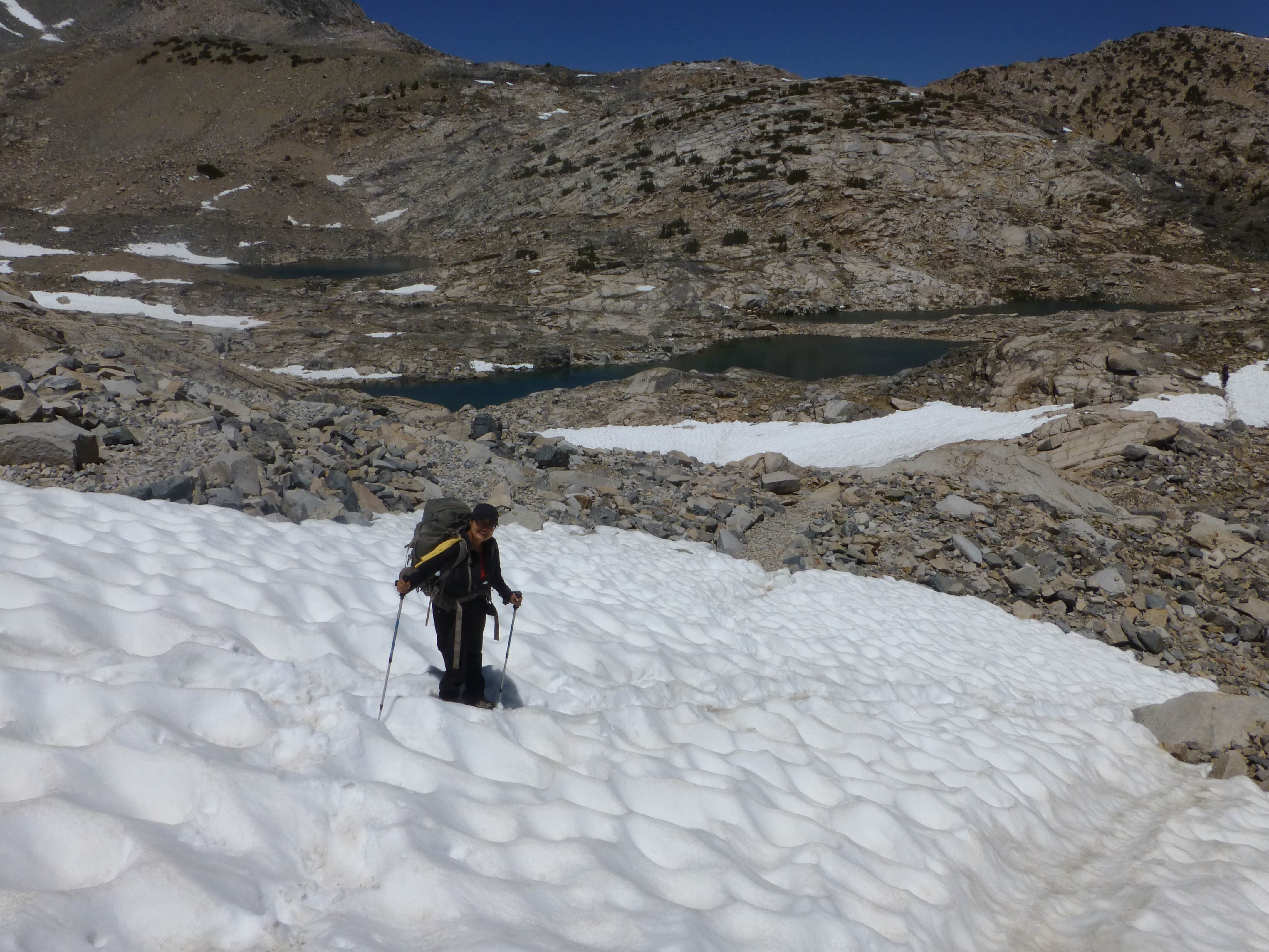
Clara and I caught up to Chris and Omi resting under some trees where we had lunch, looking down on Rae Lakes.

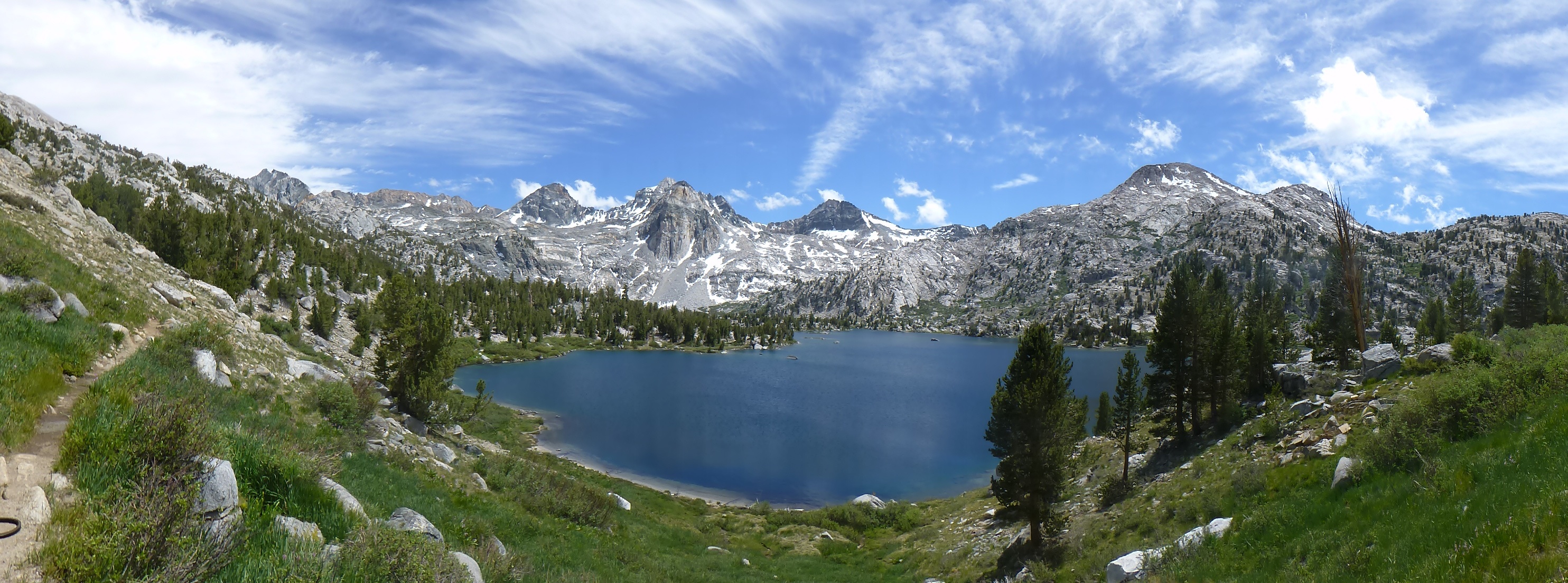
We got to Rae Lakes at about three. It took us awhile to find a good campground. The mosquitoes were out in force. We finally took a spot right at the junction to Sixty Lakes Basin.
Dragon Lake
While the three of them took a little walk around the lake and rested, I took a hike up to Dragon Lake. Took about an hour up on a use trial (sketchy to find a t times), and a bit less back. It sits in a beautiful bowl.

Camp at Rae Lakes
While the mosquitoes were heavy, it got really windy that evening and night, which while keeping it cooler, also kept the mosquitoes at bay.
Day 6: Day hike to Sixty Lakes Basin (apx, 6 miles round-trip), then Rae Lakes to Woodcreek Crossing (8 miles)

10,600’–11,300’–10,600 Sixty Lakes Basin day hike
This day was to be a day hike to Sixty Lakes Basin, and then just a short hike to move camp later. Due to the popularity of this area, they only allow you to spend one night at a lake. But as we got going it looked like some heavy weather was coming in.

Keeping the gear under wraps
We decided to do the day hike anyway, but got all our stuff covered. It was looking ominous, with a couple of light drizzles, but mostly just the constant threat of a storm.
 —
—

Sixty lakes Basin was wonderful, with all the small lakes, but it was cool and breezy. We headed back earlier than we might have, getting back to camp at about noon. Just as we got back the storm blew over and it got sunny!
After having lunch we packed up and headed out, planning to stop at Dollar Lake about three miles down. But we got there fairly early and decided to head on to Woods Creek Crossing.

Bear in the tree

Shortly before getting to the crossing we spotted a family of bears. A mother and young bear near the trail up ahead, and then another young bear way up a tree across the other side of the trial. We watched for a bit and then made a wide circle around them.

Suspension Bridge, one at a time only
Woods Creek Crossing campground was like tent city, so we headed on to look for a spot in a less crowded area. One spot we came to was for horse groups and already taken anyway.
We hiked further, and it was getting later, unclear if we would find a good spot. We were discussing whether to go back, or push on, further down. Chris volunteered to go ahead for a few minutes and if he did not find anything we’d go back. Luckily he found a very nice place near the river just a couple of minutes further on.

Day 7: Woodcreek Crossing to Lower Paradise (9 miles)

8,400’–6,600′
We got going at about 8:40. We kept up a fast pace for the first couple of hours, going all downhill.

Along the trail we spotted this Blue Lizard doing push ups to impress us.

We took a nice break by the river. We took it easier then, and still got to Lower Paradise at about 3pm.

Being a Friday, we expected it to get crowded by nightfall, being so near the trail head, but we had the place almost to ourselves.It was a large area, and there were only 2 other campers, and neither within eyesight. We made a nice early campfire at 5:30.
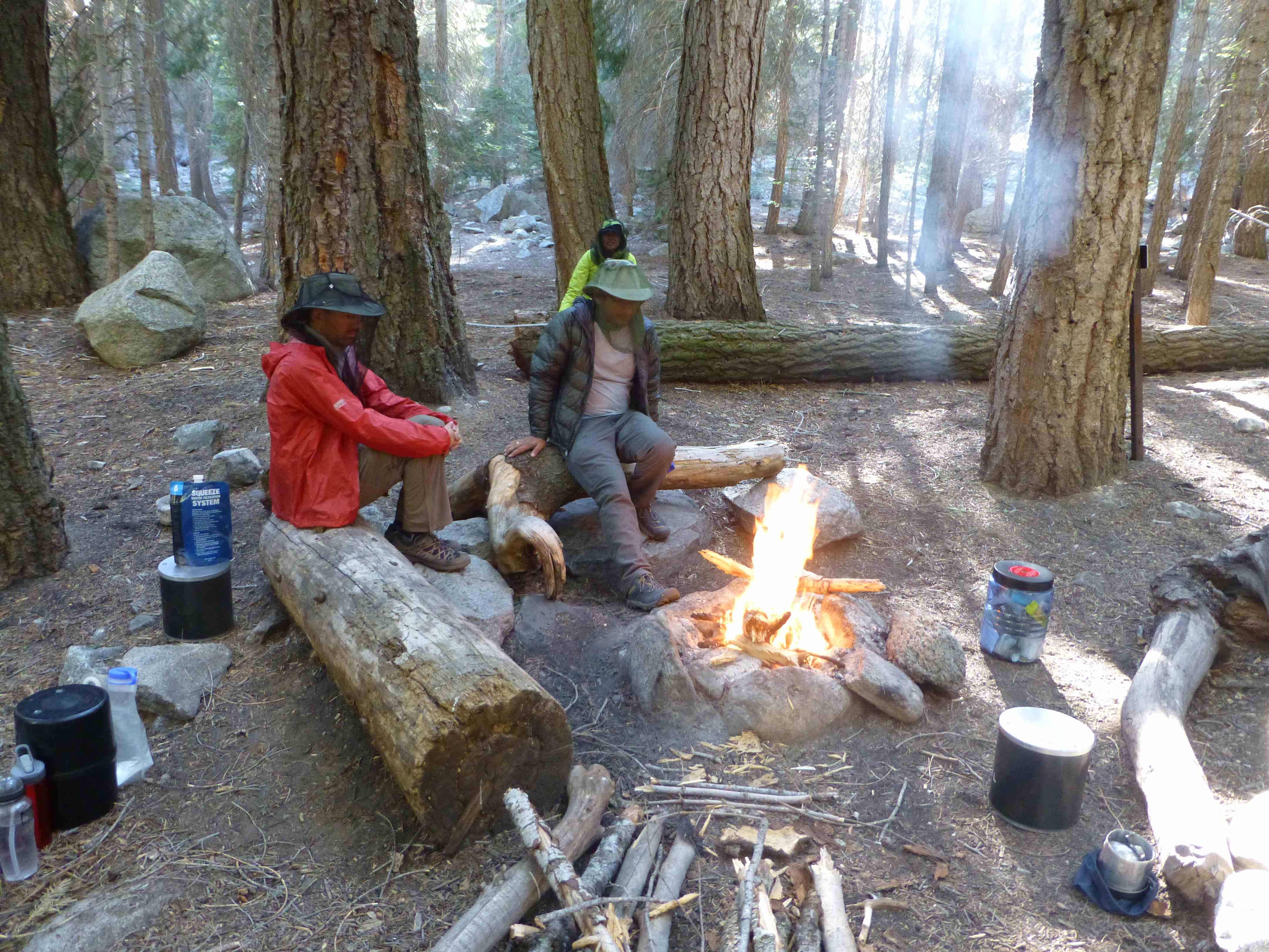
As Clara’s stove had run out of gas, we boiled water by putting a pot on hot embers that night. We kept the fire going until about 9:30 enjoying a pleasant evening.
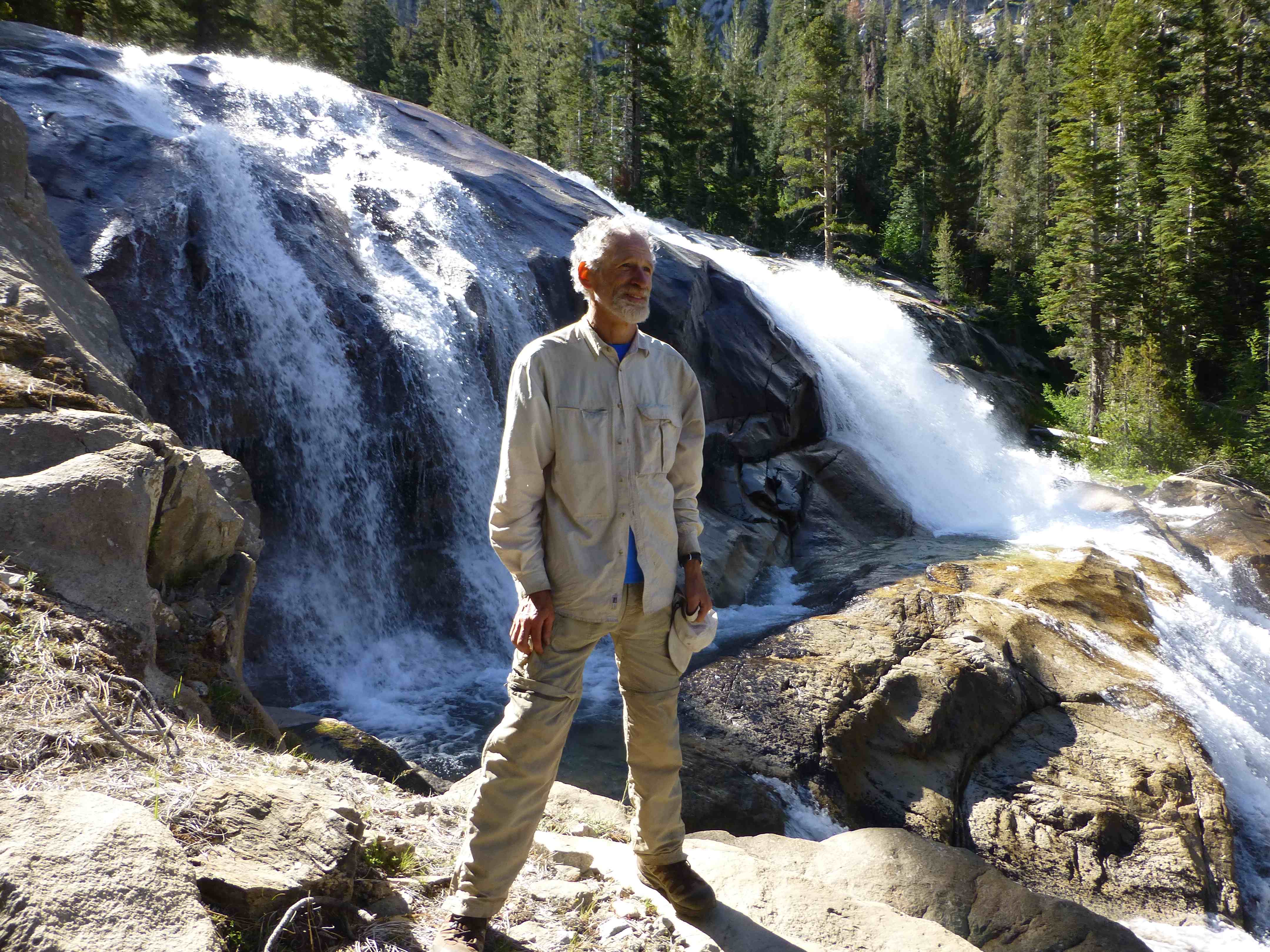
Day 8: Lower Paradise to Road’s End (6 miles)

6,600’–5,100′
Mist Falls
We got a fairly early start to do the last 6 miles out.

We did stop for some pictures at a few falls, particularly Mist Falls.

We got back to Roads End at about 10:40am.
 Back at Roads End.
To see more of my photos from this trip click here
For Chris’ Photos: click here
For Omi’s Photos click here
